The
day was one to truly test all of one's emotions and the scenes and
situations that Nick and I witnessed first hand were nothing short of
intense.
Our original forecast chase target was of Norfolk, Nebraska. It was a
good one, as the rapidly approaching dry air punched along with the Warm
Front position at max heating and the triple point play all showed up at
the table over Wayne & Stanton Counties shortly after 4pm.
We
witnessed 2 separate tornadoes, including the over 1 mile wide
preliminary EF-4 wedge that severely damaged the town of Wayne. this tornado only
injured 14 people, as it mostly hit industrial areas of the town.
This storm was from the same violent long track Tornadic Supercell
that raked across northeast Nebraska and into southeast South Dakota in
Union county.
This will be one chase day that Nick and I will never forget and we
are both truly grateful that our fellow chasers made it home safe and
that no fatalities were reported across the outbreak region.
This image was taken just outside (and to the west) of Stanton, Nebraska. A small EF-0 tornado had developed off this small cell on radar at the time.
Here the tornado is starting to rope out. Outside of Stanton, Nebraska.
The tornado now in rope out stage. Outside of Stanton, Nebraska.
As we left Stanton, NE to head North to keep following the storm; I snapped this picture as we were driving North. There wasn't a tornado at this point yet; but the storm had tons of motion. The storm was moving NE.
We turned North on Hwy 15 towards Wayne, Nebraska and the monster wedge is in front of us. This is a video grab of the tornado straight in front of us.
Another view of the wedge as it was coming into Wayne, Nebraska.
Another video grab picture of the wedge in front of us.
We encountered RFD winds way outside of the main storm as we were traveling North. Here is a radar image of the storm as it was over Wayne, NE.
You can notice the very evident debris ball located south of the town of Wayne. All the green cars are spotter network icons of active chasers that day. notice the reports of Funnel Clouds, Wall Clouds and tornadoes on the map as well.
As
we got closer to Wayne, Nebraska; we spotted damage to our left and
took a left turn onto a gravel road. We saw damage. Trees torn up; grain
bin scattered about; power poles down and much more damage. The above
picture shows the trees and the grain bin thrown about.
Grain Bin thrown about.
Downed power lines.
Tree grove ripped to shreds
Small house totally flattened.
Cows got loose after the tornado ripped through there pen. There were across from teh farmstead in the open soybean field.
Small house garage completely leveled.
Emergency vehicles responded to farmstead to check on any injuries.
Here is a radar grab image from that day.
We then left the scene of damage, after making sure everyone was okay no injuries or fatalities); and proceeded to head north along Hey 15 towards Wayne, NE.
We got a few miles down the road and were stopped by a sheriff blocking the road and allowing no travel. High voltage power lines were across the road and the pole was completely down in the residential farm off to our right.
Here is a few pictures from that area.
High Voltage Downed line across part of the driveway. House was totally destroyed with few remaining interior walls remaining.
Sheriff parked on road to block travel going North.
Sheriff of Wayne County patrolling the area and talking with drivers letting them know the situation that lie ahead. The back part of the thunderstorm is shown in the background.
We then turned around and headed south, as it was our only path back out of the area.
Shortly before we encountered Hwy 271 heading East; we stopped to take photos of the storm system. It was beautiful.
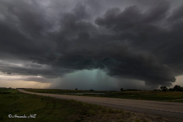
Here is a shot of the massive tornadic supercell as it was still moving to the NE.
We then drove East towards Iowa to catch Interstate 29 to head north. We stopped to take a few photos of the storm before it got too dark out.
Supercell thunderstorm at sunset.
Parting shot of the cell before we lost light.


