Nick & I left the Twin Cities metro
area at mid morning for our initial chase target of Fairmont in extreme
southeastern North Dakota. While there we had lunch with a few of the
locals and had a great chat about the upcoming fall harvest as well as
hunting seasons in the area.
After we made the short stop, we
drove just west of town to wait in initiation which did not take to long
as the cold front made swift progress into the unstable environment
lying east toward the MN border all while the turkey towers teased
overhead.
The main player storms began to take off just to our
southwest over Roberts and Grant counties in Northeastern South Dakota
and we got on the storm just northwest of New Effington as it began to
ramp up quickly and became warned on. The storm had a real nice blocky
but small non rotating wall cloud on it nearly right away which quickly
dissipated as the storm warped to outflow mode by the time it reached
I-29.
Below are some pictures from our chase day.
We had lunch at a local Cenex store in Fairmount prior to pre-chase of the day.
After lunch we went to sit outside of town and watched what we call "Turkey Towers" going up to our southwest near Fairmount, North Dakota.
Then we moved south and east into South Dakota where the cells fired up.
Nice Supercell near New Effington South Dakota shortly after initiation east of the cold front.
Supercell
storm ramping up with a nice (VIL) spike just as it went warned by
(ABR) northwest of New Effington South Dakota in northern Roberts
County.
Cell moving east toward Rosholt South Dakota and all OUTFLOW ALREADY! Here comes the shelf!
Large hail back in there on our tail! Notice the blue in color back there? (over the trees) That's the hail core. This means time to move east to stay in front of it!
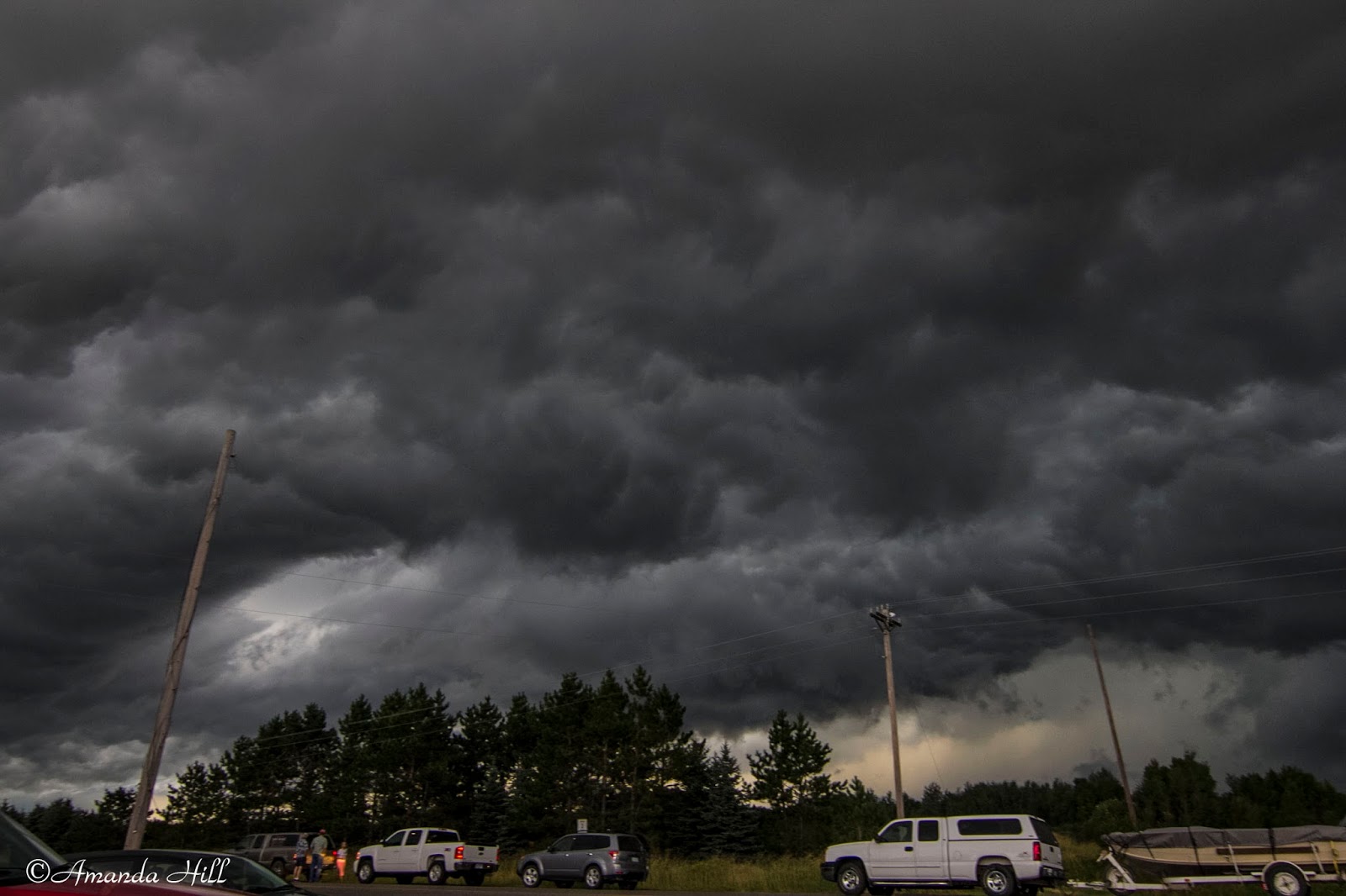
Back in Minnesota, ahead of the hail core, we stopped again East of Dumont, MN to take this picture of the very well organized shelf cloud in approaching Stevens County.
View looking North and East of the approaching storm entering into Stevens County.
The shelf approaching us closer now. It's almost time to move again!
Before escaping East again, here is a shot looking up at the angry base in Traverse County prior to the storm entering into Stevens County.
Another
shot of the bowl shaped lowering just to our northwest near Dumont MN
in northeastern Traverse county MN as a cell merger was taking place.
Could have tornadoed here if NSE parameters were better.
This
shot was taken just northeast of Dumont MN in northeastern Traverse
County MN when a cell merger took place in front of us and the storm
that was oriented to the east about to get ingested into the line began
to take in inflow and showed us a nice bowl shaped lowering looking up
into the notch. May have been the closest call of the day!
Amazing
Supercell storm with structured dark under anvil/Shelf Cloud/Rain Foot
and closing fast and visible Large Hail Core shown here over a wetland
marsh just east of Donnelly in Stevens County MN.
Another shot from the same area with the shelf getting a bit closer now.
One last shot before moving East of the shelf over the marsh. Note the bright blue off to the left of the screen - that's the hail core approaching us from the west.
After this we drove fast East to stay in front of the massive hail core that this storm was producing. According to our radar; it looked up to baseball sized.
We drove until we got on Highway 28 and starting moving East. We stopped outside of Westport Lake to record wind gust of over 60 MPH with our roof top anemometer. We then continued our way East; this time now staying in the rain; keeping a lookout for any possible damage. We saw a few branches of 2-4" in diameter broken off from trees.
In Sauk Centre we encountered this:
We reported to the National Weather Service the following via spotter network:
Swath of minor wind damage to mainly small to mid sized 3-4 inch
diameter trees in a area from near westport lake east to the western
edge of Sauk Centre. At a farm implement on the west edge of town large
poly cattle feeding troughs were thrown and wrapped around a state
highway sign on hwy 28.
All in all it was a fun chase day in the upper midwest with some photogenic severe storms for the last day of August!
Sunday, September 1, 2013
8-29-2013 Aitkin/Cass County Chase
Nick & I started out this great
chase day on the Warm Front over Northern Wadena county in west central
Minnesota, and as the afternoon turned to early evening the dominate
storm of the day got under way over south central Beltrami county.
Knowing the less than favorable road networks to our north in the Big Chippewa National Forest, we quickly raced east through Crow Wing and into Aitkin county where we knew we could intercept the storm in some of the more open visible country of the Jack Pine swamps as it began to take a more southeasterly turn down the arcing warm front near US Hwy 169. As we made the last move to the north near Hwy 210 north of Aitkin it became clear that this was no ordinary storm, but a true Minnesota Northwoods beast!
As Bill Doms once said, "if it looks mean it's mean" and this one sure did look mean!
It was very nerve tingling to see the nervous faces and to hear the voices of early holiday weekend traveler's who were clueless to the storm that lay ahead and were constantly pulling up to ask us what was going on and were was the storm.
Many cabin goers turned around and raced back south as others pulled over and stood down in the ditch.
The storm had the best structure that Nick said he had ever witnessed in Northern Minnesota. He said that it brought back memories from when he was a kid spending the summer with storms on nearby Round Lake in northern Aitkin county. He also said that this brought another past story of a historic Minnesota August tornado from 8-6-1969, the Roosevelt Lake F4 tornado that nearly tracked over and through the same area near Swatera & Haypoint townships in Northern Aitkin county as it tracked up from the southwest on its long and deadly path.
We have sent our findings and a few specific photos on to the Duluth National Weather Service to help further assist in their post storm assessment being conducted in this specific area of Cass & Aitkin counties.
It was a very fulfilling chase day as we got to witness this tornado near the end or its path near Hill City as well as with fellow chasers Doug Kiesling who watched along with us as the beast crossed the road to our North & Bob Conzemius who also witnessed the broad rain wrapped tornado earlier in its lifecycle in Cass county near Remer.
A beast of a supercell near Hill city Minnesota with spectacular structure as it moved in on our location!
Leading edge fast approaching us on US HWY 169 near Haypoint Township.
A shot up into the beast. Our friend Doug Kiesling was just in front of us (car in photo) taking the same shots.
The broad remnant tornadic circulation approaching US HWY 169 between Haypoint Township and Hill City likely at the end of its northwest to southeast track and likely weak at this point.
Main action area with broad tornadic circulation south/southwest of Hill City MN.
One of my favorite shots from the day. This is looking under the shelf; looking east; in a rare open area field up in Northern MN along HWY 69.
Locals and travelers who were nervous and confused created mini traffic jams in the middle of no where as the stormy skies churned overhead!
Nick shooting video and enjoying the powerful storm as the sun faded in the west and it attempted to do it again near Hassman township north of Aitkin.
Super long inflow tail racing into the storm!
The storm base with decent inflow as the sun sets over Aitkin County near Hassman.
It was a great chase day for a Northern MN
Knowing the less than favorable road networks to our north in the Big Chippewa National Forest, we quickly raced east through Crow Wing and into Aitkin county where we knew we could intercept the storm in some of the more open visible country of the Jack Pine swamps as it began to take a more southeasterly turn down the arcing warm front near US Hwy 169. As we made the last move to the north near Hwy 210 north of Aitkin it became clear that this was no ordinary storm, but a true Minnesota Northwoods beast!
As Bill Doms once said, "if it looks mean it's mean" and this one sure did look mean!
It was very nerve tingling to see the nervous faces and to hear the voices of early holiday weekend traveler's who were clueless to the storm that lay ahead and were constantly pulling up to ask us what was going on and were was the storm.
Many cabin goers turned around and raced back south as others pulled over and stood down in the ditch.
The storm had the best structure that Nick said he had ever witnessed in Northern Minnesota. He said that it brought back memories from when he was a kid spending the summer with storms on nearby Round Lake in northern Aitkin county. He also said that this brought another past story of a historic Minnesota August tornado from 8-6-1969, the Roosevelt Lake F4 tornado that nearly tracked over and through the same area near Swatera & Haypoint townships in Northern Aitkin county as it tracked up from the southwest on its long and deadly path.
We have sent our findings and a few specific photos on to the Duluth National Weather Service to help further assist in their post storm assessment being conducted in this specific area of Cass & Aitkin counties.
It was a very fulfilling chase day as we got to witness this tornado near the end or its path near Hill City as well as with fellow chasers Doug Kiesling who watched along with us as the beast crossed the road to our North & Bob Conzemius who also witnessed the broad rain wrapped tornado earlier in its lifecycle in Cass county near Remer.
A beast of a supercell near Hill city Minnesota with spectacular structure as it moved in on our location!
Leading edge fast approaching us on US HWY 169 near Haypoint Township.
A shot up into the beast. Our friend Doug Kiesling was just in front of us (car in photo) taking the same shots.
The broad remnant tornadic circulation approaching US HWY 169 between Haypoint Township and Hill City likely at the end of its northwest to southeast track and likely weak at this point.
Main action area with broad tornadic circulation south/southwest of Hill City MN.
One of my favorite shots from the day. This is looking under the shelf; looking east; in a rare open area field up in Northern MN along HWY 69.
Locals and travelers who were nervous and confused created mini traffic jams in the middle of no where as the stormy skies churned overhead!
Nick shooting video and enjoying the powerful storm as the sun faded in the west and it attempted to do it again near Hassman township north of Aitkin.
Super long inflow tail racing into the storm!
The storm base with decent inflow as the sun sets over Aitkin County near Hassman.
It was a great chase day for a Northern MN
Friday, August 30, 2013
Minnesota Tornado Count for 2013: A few added!
The National Weather Service in Chanhassen put out this public information statement about the Tornado season in Minnesota this year; as well as information about a few they added to the count after research through video, pictures and chaser accounts. Read below.
This confirms that the August 6th storm produced a brief rain wrapped tornado that we captured right before we got hit with the huge baseball sized hail.
=========================================================================
Tornadoes in 2013 in the 51 Counties Covered by NWS Chanhassen
The
tornado season has been very quiet this year, with only six so far in
the 51 counties covered by Chanhassen. If we get no more tornadoes or
very few additional tornadoes, it will be the quietest in our area since
2007, and the second quietest since 1988. In
1988, there were only two tornadoes in the 51 counties covered by
Chanhassen, and in 2007, there were only three tornadoes in the 51
counties.
All tornadoes in the Chanhassen area this year have been rated EF-0.
The
overall total so far this year appears to be 11 in Minnesota and 15 in
Wisconsin. Here is a link to the Wisconsin tornado list from August
12: www.crh.noaa.gov/news/display_cmsstory.php One more Wisconsin tornado after August 12 brings that total to 15.
The data below are still subject to change if photos, video or other evidence becomes known. The
six tornadoes listed below have been verified through a combination of
photos, videos and some damage surveys. In the case of August 6, a lot
of video and photos were examined where the Kandiyohi County storm had
become rain-wrapped and the brief tornado was shrouded from the view of
most people in the area. Damage surveys were also conducted for the June
21 tornado and the August 6 Kandiyohi County tornado.
1.
June 21, 3:46 a.m. Chisago County Minnesota, southeast side of Wyoming.
Rated EF-0. Path length 0.5 mile. Wind speed 65 to 75 mph.
2.
July 22, 4:45 p.m. Eau Claire County Wisconsin, four miles
west-southwest of Augusta. Rated EF-0. Path length 0.3 mile. Wind speed
65 to 70 mph.
3.
August 6, 4:00 p.m. Stevens County Minnesota, three miles northeast of
Chokio. Rated EF-0. Path length 0.1 mile. Wind speed around 65 mph.
4.
August 6, 4:30 p.m. Stevens County Minnesota, two miles north-northwest
of Hancock. Rated EF-0. Path length 0.1 mile. Wind speed around 65 mph.
5.
August 6, 5:17 p.m. Kandiyohi County Minnesota, four miles east of
Sunburg. Rated EF-0. Path length 0.2 mile. Wind speed around 65 mph.
6.
August 21, 5:25 p.m. Chippewa County Wisconsin, four miles northwest of
Cadott. Rated EF-0. Path length 1.2 mile. Wind speed 65 to 75 mph.
Wednesday, August 7, 2013
8-6-13 West Central Minnesota Chase
The day started out as most days this
2013, faced with great doubt and caution on the forecast actually coming
to fruition.
BUT as the morning hours turned into afternoon it was
clear that it was time to go and FAST!!, as a red box was quickly
hoisted up by mid afternoon for much of the central portion of Minnesota;
just as the the man dominate Supercell was just developing over
southwestern Traverse county MN.
Nick and I got a bit of a late start
and decided to intercept the storm in western Pope county south of
Starbuck and stay with it to the southeast into Kandiyohi county and
beyond. As the storm crossed Stevens county it did exhibit some tornadic
characteristics near and west of Morris as it was playing with the warm
front , but the southeasterly backed surface winds were kinda bunk and
not helping matters. However it was tornado warned storm as it crossed the
county towards us.
Jessica Lemmerman
was out spotting just west of Morris on HWY 28, and captured a few
photos of the storm when it had good inflow and had a rotating, well
organized wall cloud with a small intermittent funnel cloud associated
with it at times. Finally as the beast went outflow dominate and moved
onto and over the glacial ridge of Northern Kandiyohi county as Nick
& I were riding on the southern razors edge with a great view up
into the notch, she decided to move more south than east and we got to
play in the very large Hail from 2".
Our largest stone found and
measured that was 3 inches in diameter as we were positioned 5 miles west of New London on
county road 40. The storm also had a photogenic shelf cloud on the
leading edge along with some 60MPH wind gusts as it passed over head and
ate us.
Still a great chase day for 2013 up here in Minnestormless
2013!
Below are some photos from our chase day.
"A Fist Full of HAIL"! or maybe "for a few Hailstones more"!
Nick is holding a handful of hailstones that we found around the car after the storm passed.
This was a big, solid hailstone measuring around 2.75".
Shelf cloud evident looking to our north at this position.
Looking south a the shelf cloud as we were positioned south of Starbuck, MN
Another picture of the Shelf Cloud. This storm was producing 60 MPH winds and blowing Dirt around here in rural KandiyohiCounty, MN.
This storm was tornado warned at the time I took this picture. Here you are looking up into the notch of the storm as we sat on Hwy 71, just 5 miles west of New London, MN. This shown a wall cloud lowering getting obscured in the rain and hail. This picture was taken just shortly before we got ate with the hail.
Picture of a piece of hail we found to the right of the car. This stone measured at 3". It was the largest hailstone that Nick and I could find in the wooded area of an abandoned farm yard. The hail stone had a jagged spike to it, and considered baseball size! It was also nice to chat with Todd Krause at National Weather Service - Chanhassen in the Twin Cities as we reported the size of hail we had, over the intense roar of the hail as we were getting blasted.
Here is a picture of the shelf cloud taken from in the car as we were near the town of Regel, MN.
Beautiful picture of the shelf cloud. Roadway to Heaven!
Low hanging shelf cloud shown here in the rural county moving over Minnesota's Glacial Ridge region landscape.
Measured winds of 52MPH at this point and we also had a 2nd batch of 1" hail also soon after the storm overtook us.
Our friend Jesse Lemmerman was helping us spot out in the Morris, MN area and was sending us text pictures on her phone as the things that her, Jason Howe and Roger Hill (my dad) was seeing at the time. They were spotting near the Morris Airport.
Here is some of her photos she sent.
Photo taken by our close friend Jessica Lemmerman
taken from 4 miles west of Morris at the Morris MN regional airport of
the storm with wall cloud and visible inflow tail over Stevens county.
The storm was tornado warned at this time 4:28pm.
A
photo taken from the far southwestern back edge of the supercell of a
lowering with reported visible rotation near the Morris city limits in
Stevens County MN.
2.25" Hen Egg sized hailstones was the common rule in the city of Morris as the storm moved through severely damaging cars and even structures in and around the area. This photo was taken in the city of Morris. This would have been even a more serious situation had it happened just 2 days later when the Stevens county outdoor fair begins! This photo is from my mom of the hailstone that hit near her work.
Wall cloud lowering looking east to the city of Morris on Hwy 28 on storms back edge.
HAIL FIGHT!! done right Minnesota style with true tennis balls,Golf Balls as well as a Baseball thrown in for good measure as Nick runs to escape my throw!! You have to have a little fun after a hail storm :-)
We then let the storms head to our south and followed them back towards the cities along Hwy 55. We got a wind and hail report in at Kimball, MN - helping in aide the warning process for Wright County, MN.
Thank you to all those who watched our live stream. Be sure to look for website updates soon at www.prairiewindchasers.com
Sunday, June 30, 2013
6/29/13 Stevens County,MN Tornado Disaster Response Exercise
The Stevens County emergency services
held a multi-agency Tornado disaster response and mitigation exercise on
Saturday in the city of Donnelly just northwest of Morris MN. The
exercise was well attended by over 130 participants and volunteers who
put their skills to action in a real world scenario of a EF-3 tornado
forming west of the town of Donnelly and tracking Northeastward through
the towns northern and central quadrants damaging over 85% of the town
and presenting multiple issues and challenges to the first responders
and personnel who were first on the scene of this mock drill event.
The
exercise was attended by many agencies including local,county,state and
federal entities.
Nick and I also participated in the exercise and gave a
opening severe weather spotter overview as well as a talk on the real
world and mental aspects that those first on the scene of severe tornado
damage may encounter.
Nick showing some recent storm photos of tornadic storms we have shot from the last few weeks.
A large crowd at the Donnelly City Hall with many of the real world scenario volunteers painted up and dirt and mud covered ready for the event to begin.
Local Stevens County First responders and Fire Fighters tend to the needs of tornado victims during the drill in Donnelly.
A injured citizen being cared for by Stevens counties finest responders including our friend, Justin Howe.
The
Morris fire rig on state HWY 9 in Donnelly staging at the AG CO-OP as
in a scenario of a HAZ-MAT chemical leak or release caused by the
tornado in the damage track.
Emergency responders taking things seriously in a real world tornado disaster drill exercise.
American Red Cross on the scene as well as the Stevens county mobile emergency communications and disaster response trailer at the command and control point outside of town.
Stevens County Sheriff's Office Mobile command center trailer in full use.
Stevens County ambulance service on the scene at the Temporary triage check point on the outside of the damage track.
A roll playing victim lay in the side of the street in Donnelly with a severe neck laceration and broken bones caused by the EF-3 tornado.
The Command Trailer.
Subscribe to:
Posts (Atom)