Pages

Monday, April 25, 2016

April 24, 2016: First Chase of the 2016 Season

We saw the slight risk slated for Sunday afternoon and the wording for possible supercells; and said we have to at least try it since it is so close to home.

Saturday afternoon we headed down to Iowa in search of cones. Ice Cream Cones that is.. at Le Mars, Iowa.

After a stop at the Ice Cream Parlor in downtown Le Mars; we set up ourselves with an overnight stop in Sioux City, IA.

Sunday morning turned our slight risk for a more northerly play along the SD/NE/IA/MN borders. We went west in the late morning and ended up going through heavy rain around Sioux Falls, SD.

The lightning show around Sioux Falls was awesome. Unfortunately we were driving the whole time and the rain was heavy and could not take any pictures.

My our chase mascot was happy he was out for his first chase of the year. It was a good test of the equipment and we are ready to go.

Bring on the storms Mother Nature!!

Here are a couple pictures from the day.


Our very long time chase mascot: Mister Prairie Dog. Here is his kicking off the 2016 chase season near Nebraska.


One of the very few, if not only storm, that tried to remain discrete along the dryline in Eastern Nebraska. When we pushed on the other side of the small hail and rain core; we were treated to this great spectacular sky.

Severe Weather Awareness - the rest of the topics

Things got a bit busy towards the end of Minnesota's Severe Weather Awareness Week, but here is the rest of the topics that were covered

Flooding

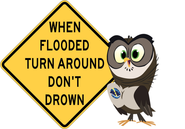
Flooding is something that you do not want to mess around with. Remember - Turn Around - Don't Drown! 


Tornado Safety

As the severe weather season starts to ramp up - here are some very important Tornado safety information that you should be aware of.


and Lastly Heat.....

Heat Waves Kill. From 2000-2010, there was 35 deaths that were directly attributable to the extreme heat in Minnesota.  When heat related products are going to be a part of the forecast, the National Weather Service will put out a couple of products.

Excessive Heat Outlooks will be issued when the potential exists for an excessive heat even in the next 3 to 7 days. This outlooks provides information to those who need considerable lead time to prepare for the event

Excessive Heat Watches: These are issued when conditions are favorable for an excessive heat even in the next 24 to 72 hours. The watch is issued when the risk of a heat wave has increased but the occurrence and timing is still uncertain. It provides enough lead time so those that need to prepare, can do so.

Excessive Heat Warning/Advisories are issued when excessive heat event is expected in the next 36 hours. these are issued when an excessive heat event is occurring, is imminent or has a very high probability of occurring. the warning is used for conditions posing a threat to life. an advisory is for less serious conditions that cause significant discomfort or inconvenience and if caution is not taken could lead to a threat to life.

Heat Index Chart.
Heat index is sometimes referred to the apparent temperature given in Fahrenheit. The heat index is a measure of how hot it really feels. Kind of like our windchill factor, but opposite.

Below is a chart to keep handy on those heat days.


Tuesday, April 12, 2016

April 12: MN Severe WX Awareness Week : Severe Storms, Lightning and Hail

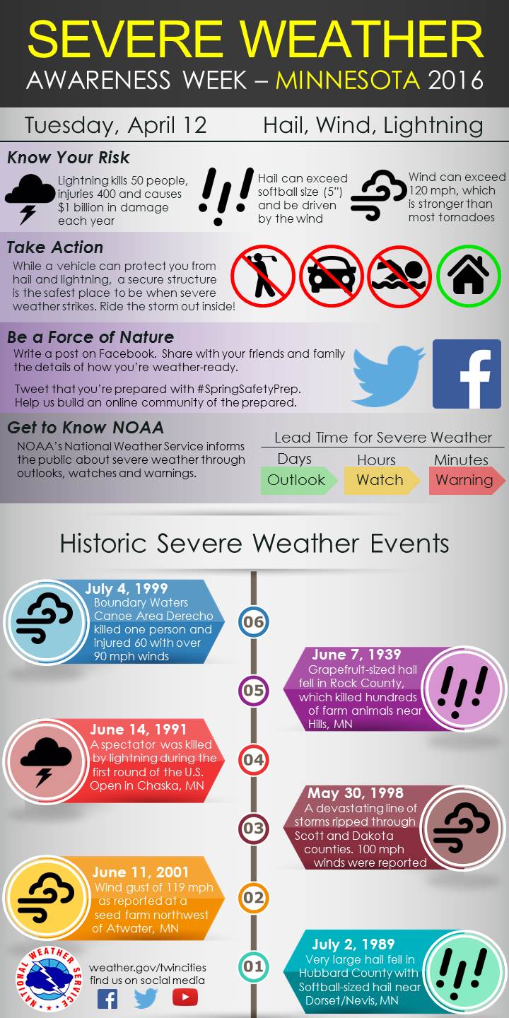
Today the topic is Severe Storms, Lightning and Hail. Below is a graphic that can help better understand how to prepare for these events and stay safe!


Remember - When Thunder Roars - Head Indoors!

Monday, April 11, 2016

MN Severe Weather Awareness Week April 11: Watches & Warnings


It's that Annual time again - when we reflect on Severe Weather Awareness Week in MN.

Every year around this time it is great to brush up on the terminology and prepare ourselves for the upcoming season. Today's topic is below. Stayed tuned the rest of the week for the rest of the topics!

Monday April 11th - Watches and Warnings

We reflect on the terms of Watches and warnings in severe weather. Do you know the difference? Here is a handy graphic to explain it all!