We went out to the farm after stopping by Jessica Becker's graduation party in Buffalo.
We went to watch the fireworks show in Morris for the Prairie Pioneer Days. Below is a couple of shots from the show.


Sunday - we woke up to moderate risk; and started to make sure the people was aware of the situation that could unfold that afternoon. Two big events were in the area. Big Stone County Fair in Clinton and the Prairie Pioneer Days in Morris, MN.
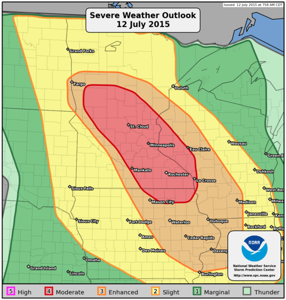
The Public Weather Outlook issued by the SPC @ 8am CDT
The models all kept showing cells to blow up right around the Fairmount, ND area.
With the car set up and all the batteries charged - we set out for Fairmount, ND to wait things out. We had a quick lunch at the gas station and then went and sat and waiting just outside town. We had a few pop up showers come over us, but the cu field was trying to go.
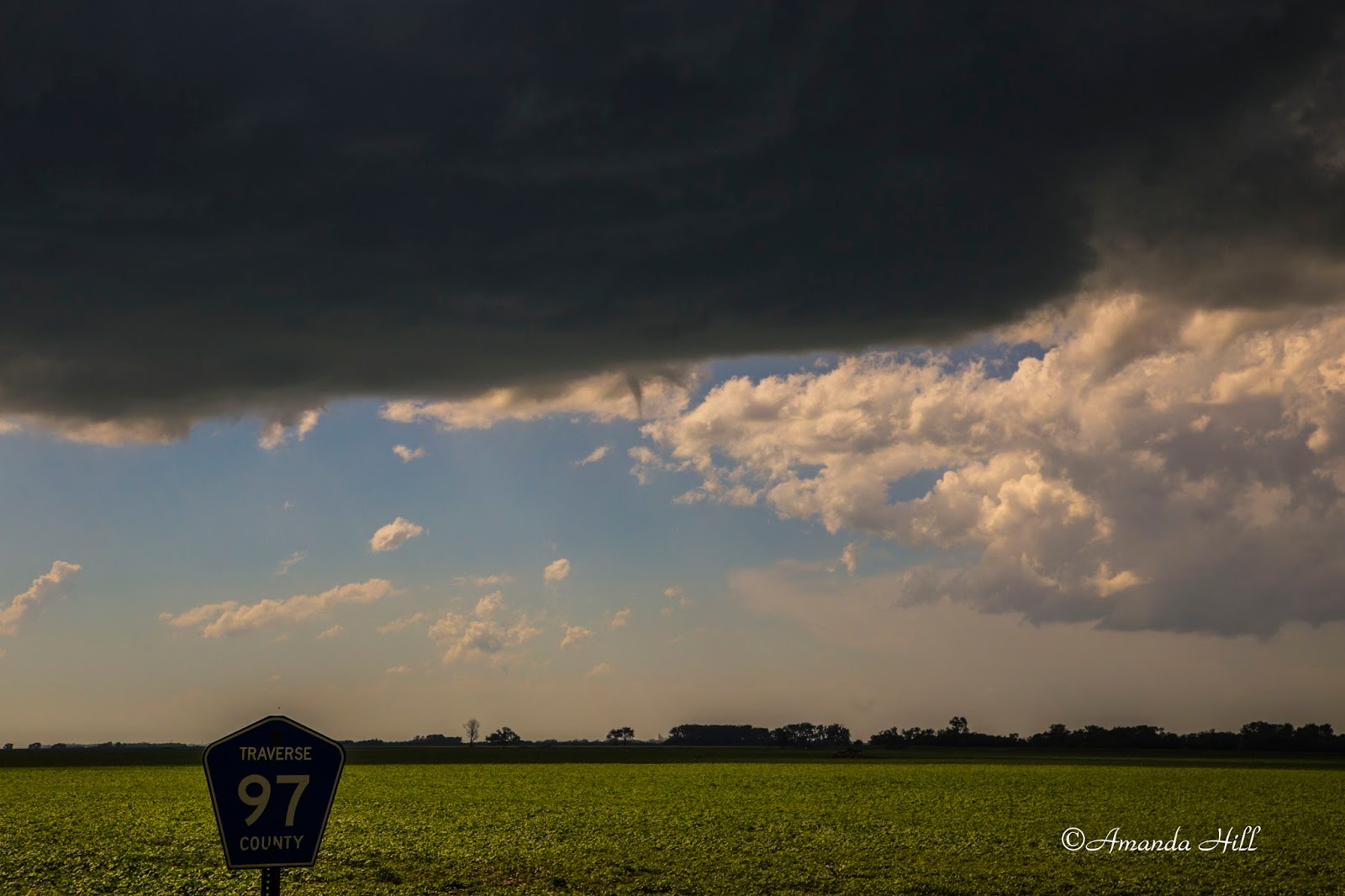
We headed back east to Hwy 75 and went a bit north and sat on a dirt road. This cell was starting to look like it could do something.. and sure enough - we saw a small needle funnel.

The storm as it got going.

A few minutes later this small needle funnel appeared.
another cell showed us a small needle funnel as well.
We went further up the north on Hwy 75 and quickly pulled off by a farmers house; as we saw rapid circulation. As soon as we got out of the car, the tornado appeared. We were looking to the northwest in these following shots. This was just south of the small town of Duran, MN


The tornado quickly was dissipating - and soon would be gone right after this.

A rule to always to keep your head on a swivel - another tornado was formed and on the ground to our southeast of our location.

After this we tried to head east to keep up with the storm. We followed it out of Doran, MN - and continued east. We started to run into hail so we dropped back and bit and tried to find a road heading south. We ended up going to Wheaton on some back roads; then onto Hwy 27 towards Herman, MN.
At this point we called our friends for Stevens County EM to give them the all clear as everything went to the East of them.
Outside of Herman, MN along Hwy 27 we ran into Eric Whitehill. We stopped and chatted, and observed the storm from here.


We left Eric and headed east towards Hwy 59. We went south on Hwy 59 and then cut east on some gravel road and ended up on hwy 28. We kept going east on Hwy 28, with the storm off to our north.
In Starbuck we stopped to get gas and then went south of town as another tornado warning was issued.


Looking north along a side road off County Road 18 in Pope County, MN

Looking east along County Road 18 in Pope County, MN
From here we left the storm. It was starting to go into a line and we wanted to stay ahead of the rain. we made it into the cities around 11pm that night and the rain was just on our tail. We quickly unpacked the necessary items to not leave in the car and called it a night and watched the rain and wind come down.
The Big Stone County Fair thanked us for keeping them in the loop for any potential severe weather and was glad that nothing came there way.
It was a fun little chase day!
No comments:
Post a Comment